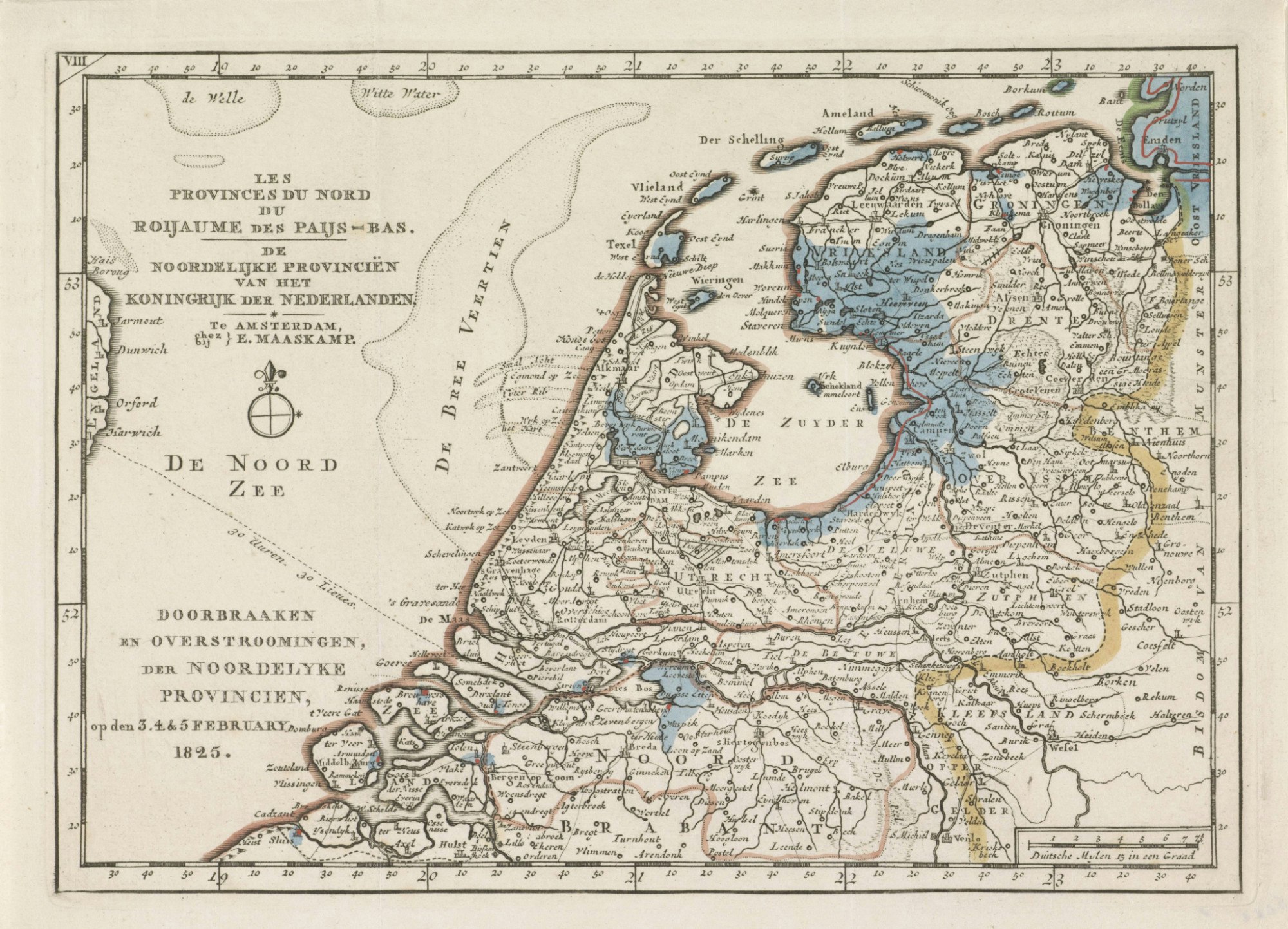
The forgotten flood disaster of 1825
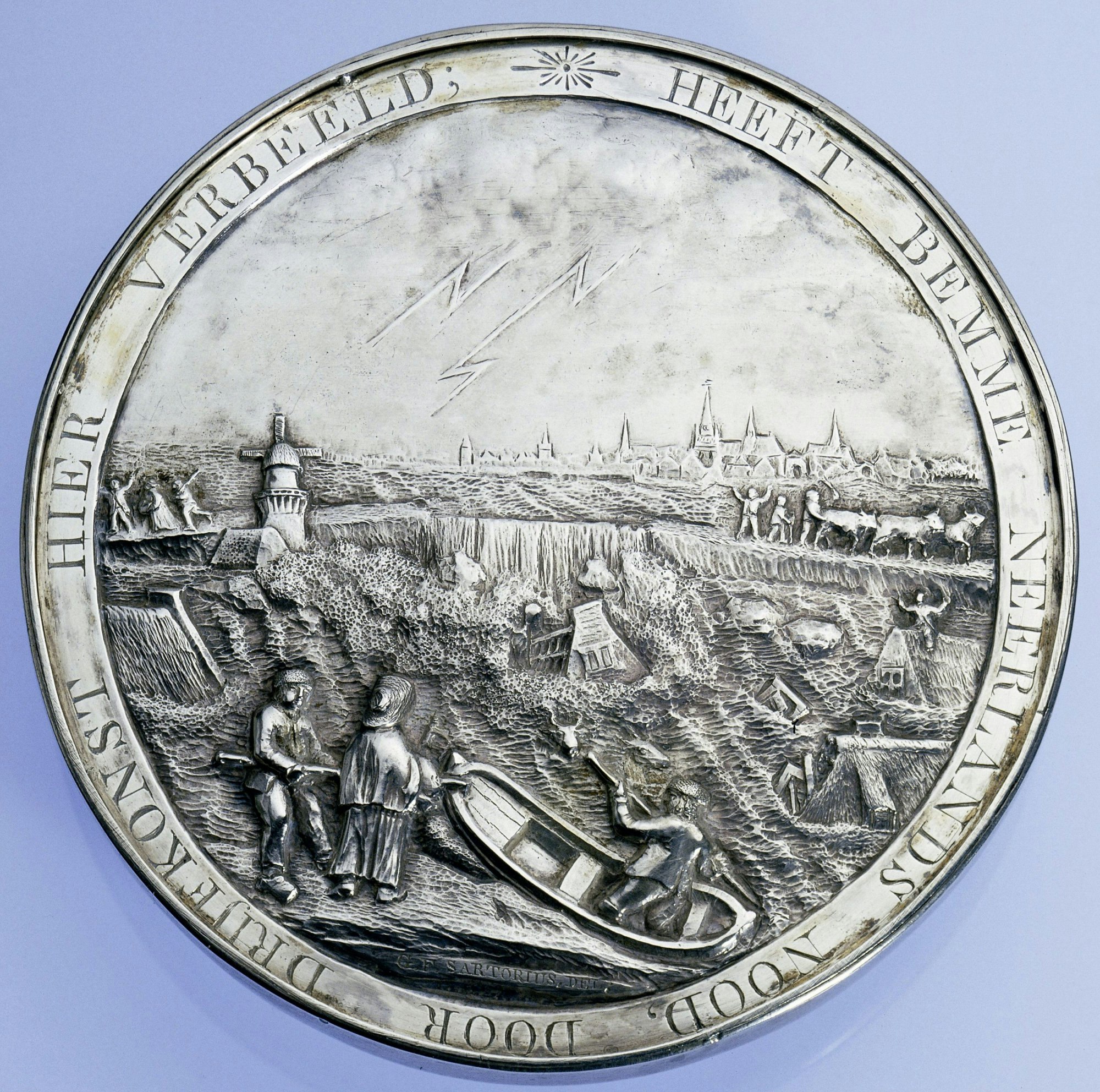
22 dyke breaches, 6 flooded provinces, 60% of Friesland under water, and 379 fatalities. In 2025, it will be 2 centuries since most of the north of the Netherlands was submerged. The 1825 flood was the largest flood disaster of the 19th century. Since then, our knowledge of water management has expanded tremendously.
‘The reason this disaster is largely forgotten, is because of the 1953 North Sea flood. That event is much fresher in people’s memory. Moreover, not all provinces were equally hard-hit in 1825,’ says Bert Toussaint, historian at Rijkswaterstaat.
In 1825, the Zuiderzee still existed, an open inland sea. The storm surge that swept across the land in early February 1825 caused the Zuiderzee dykes to collapse. ‘A powerful storm moved from the Atlantic Ocean towards the North Sea, with violent gusts pounding the coast with immense force,’ Toussaint explains.
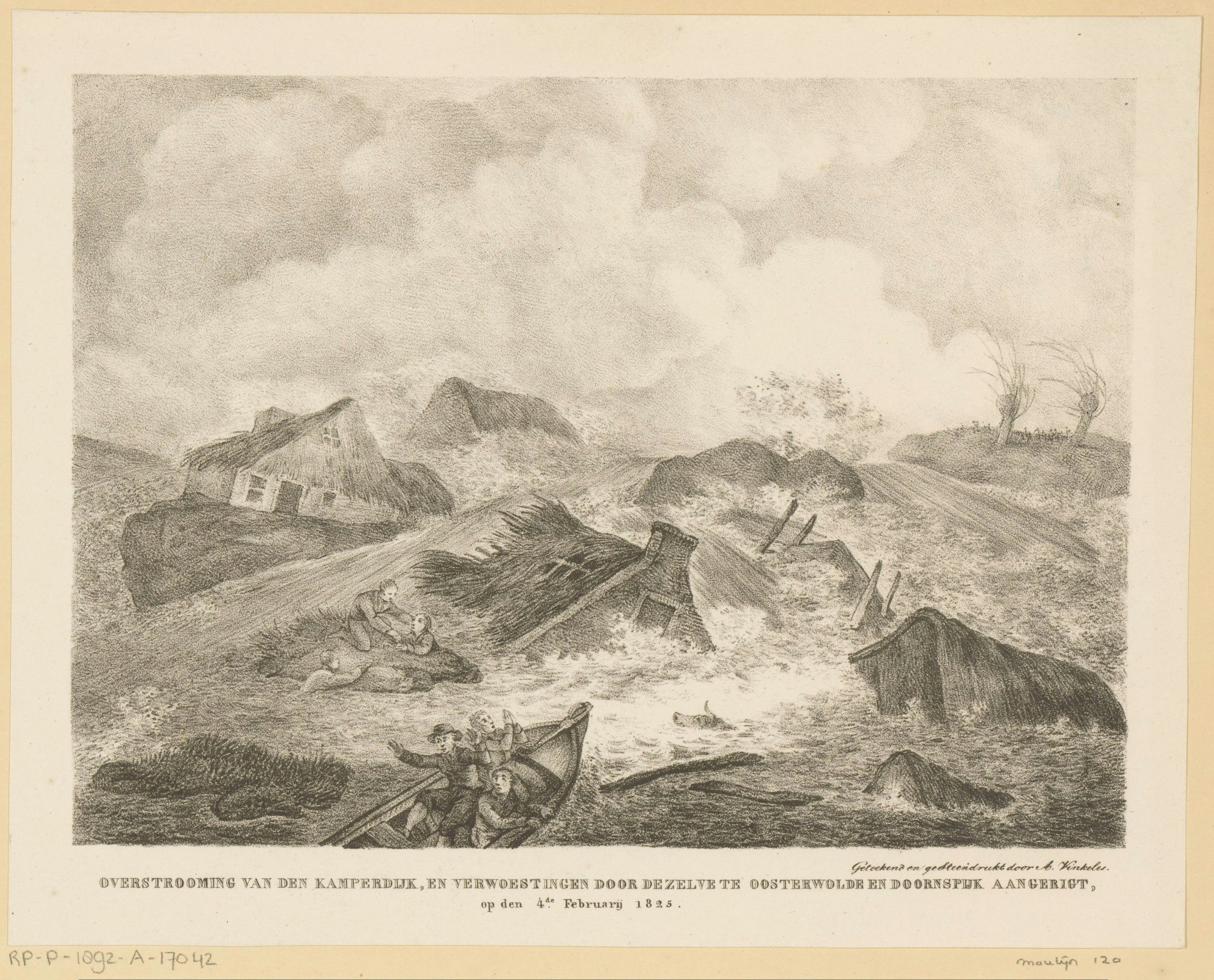
Northwest Overijssel almost entirely underwater
The highest number of casualties occurred in Overijssel, where 305 people lost their lives. Severe dyke breaches also occurred in Groningen, Friesland, Gelderland, Utrecht, and Holland.
Yet, people responded with relative resignation. ‘Flooding was not unusual, and there was a culture of acceptance. Many people believed it was God’s will,’ says Toussaint.
Give generously!
Relief efforts were organised for the affected areas, coordinated by the government under the slogan ‘Give generously!’. Booklets were published to encourage people to donate, a campaign supported by King Willem I himself.
The fastest route to the sea
During the 1825 flood, the Corps Ingenieurs (Corps of Engineers), as Rijkswaterstaat was known at the time, was already building its knowledge of water management. For instance, river maps were created to track water flows.
It was only from 1850 onwards that a national strategy for water management was introduced. ‘The aim was to channel water to the sea more quickly and efficiently. New river mouths were created, side branches were closed off, and dykes were raised. This approach laid the foundation for modern water management,’ Toussaint explains.
Today, we continue to strengthen our dykes through the Flood Protection Programme (Hoogwaterbeschermingsprogramma, HWBP). Rijkswaterstaat and 21 water authorities are collaborating on the largest dyke reinforcement operation since the Delta Works. Over the next 30 years, 1,400 km of dykes and 400 sluices and pumping stations will be reinforced.
From Zuiderzee to IJsselmeer
In 1932, the Zuiderzee was closed off by the Afsluitdijk, a 32.5 km-long barrier protecting the Netherlands from flooding. Since then, the Zuiderzee has been known as the IJsselmeer.
In 2018, work began to reinforce the Afsluitdijk. The drainage capacity from the IJsselmeer will be increased, and new lock and sluice systems will be installed along the shipping routes.
From mapping rivers to global expertise
Since the 19th century, the Netherlands has been working tirelessly to protect the land from water. What began with mapping rivers has evolved into a globally recognised leadership role in water management and coastal defence.